Government Grants
Business Grants
Home Owner Programs
Federal Programs
About Us
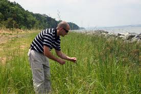
Great Lakes Remote Sensing
This is a continuing 2017 Great Lakes Restoration Initiative - Cooperative Agreement for an on-going project to operationally monitor and map changes using remote sensing technologies across the Great Lake Basin.
Specifically directed towards temporal mapping of Great Lakes Habitats and Wetlands
using new, integrated remote sensing technologies.
This is a notice of intent to award single source cooperative agreements to the University of Minnesota and Michigan Technological University without competition under justification 505DM 2. 1 4. B.
1, 2 and 4. Competition for the award is not practical as the eligible applicants have the necessary experience and resources to accomplish this project which includes peta-scale datasets and computing to derive the end products.
This is a collaborative project to fuse the past strengths and accomplishments of the applicants into a derived multi-temporal habitat and wetland change mapping program.
Who's Eligible
Obtain Full Opportunity Text:
https://www.grants.gov/
Additional Information of Eligibility:
There is not an application process for this funding opportunity.
This is a notice of intent to award single source cooperative agreements to the University of Minnesota and Michigan Technological University without competition under justification 505DM 2.14.
B.
1, 2 and 4.
Full Opportunity Web Address:
https://www.grants.gov/
Contact:
Agency Email Description:
Program Officer
Agency Email:
Date Posted:
2018-03-02
Application Due Date:
Archive Date:
2018-03-10
Social Entrepreneurship
Spotlight
Why People Buy from Social Enterprises?

The Guardian has compiled a list of responses to its latest open thread, and has announced the winner of the social enterprise gift hamper packed with presents.
Learn How to Identify and Avoid Grant Scams
