Government Grants
Business Grants
Home Owner Programs
Federal Programs
About Us
Cooperative Ecosystem Studies Unit, Piedmont-South Atlantic Coast CESU
The US Geological Survey, John Wesley Powell Center for Analysis and Synthesis, is offering a funding opportunity to address the role of land use infrastructure, and river modification on flood frequency using the Budyko framework.
The goal is to quantify how human modifications of the land surface,
including urbanization, transportation networks, and river regulation, such as dams, diversions, and levees, influence the risk of flood events.
Specific objectives include development of a database of flow and floods from paired sets of stream gages in different types of human-modified and unmodified areas, and use it to evaluate the effects of different modifications on flood frequency.
The research is a necessary and very applied extension of ongoing research using existing Budyko frameworks/relationships to quantify how human modification of the land surface influences the frequency and severity of flood events.
The goal is to quantify how human modifications of the land surface,

including urbanization, transportation networks, and river regulation, such as dams, diversions, and levees, influence the risk of flood events.
Specific objectives include development of a database of flow and floods from paired sets of stream gages in different types of human-modified and unmodified areas, and use it to evaluate the effects of different modifications on flood frequency.
The research is a necessary and very applied extension of ongoing research using existing Budyko frameworks/relationships to quantify how human modification of the land surface influences the frequency and severity of flood events.
Who's Eligible
Relevant Nonprofit Program Categories
Obtain Full Opportunity Text:
https://www.grants.gov/
Additional Information of Eligibility:
This financial assistance opportunity is being issued under a Cooperative Ecosystem Studies Unit (CESU) Program.
CESU¿s are partnerships that provide research, technical assistance, and education.
Eligible recipients must be participating partners of Piedmont-South Atlantic Coast Cooperative Ecosystem Studies Unit Program.
Full Opportunity Web Address:
https://www.grants.gov/
Contact:
Agency Email Description:
Contract Specialist
Agency Email:
Date Posted:
2019-08-22
Application Due Date:
Archive Date:
2019-11-22
Social Entrepreneurship
Spotlight
A Bar That Saves Children’s Lives
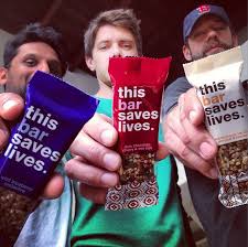
Ryan Devlin, Todd Grinnell and Ravi Patel have traveled to Africa on a humanitarian trip a few years back, encountering children suffering from severe malnutrition get healthy through Plumpy’Nut®.
Learn How to Identify and Avoid Grant Scams
