Government Grants
Business Grants
Home Owner Programs
Federal Programs
About Us
BLM-CO: Interpretation, Education, and Protection of Resources on Public Lands in Western Colorado
The Bureau of Land Management (BLM) Colorado's 8. 3 million acres of public lands, along with 27 million acres of mineral estate, are concentrated primarily in the western portion of the State.
The lands range from alpine tundra, colorful canyons, and mesas in the southwest, to rolling
sage-covered hills in the northwest.
These public lands play a vital role in providing open space and contribute to Colorado's quality of life.
The public lands and resources administered by the BLM are among Colorado's greatest assets, benefitting local communities and our nation.
Every year, BLM-managed public lands support thousands of jobs in Colorado and draw millions of visitors.
Colorado's public lands support diverse lifestyles and livelihoods on healthy and working landscapes in Colorado's backyard.
BLM Colorado's National Conservation Lands encompass approximately one million acres, or one-eighth of all BLM land in the state.In addition, BLM Colorado manages the following:â¿¢ 3 national conservation areasâ¿¢ 53 wilderness study areasâ¿¢ 5 wilderness areasâ¿¢ 1 national historic trailâ¿¢ 1 national scenic trail â¿¢ 2 national monumentsUnlike many other recreation destinations, BLM Colorado's public lands are still quite rustic.
There are no entrance stations and comparatively few developed recreation areas.
BLM Colorado focuses recreation on the visitors' freedom to choose where to go and what to do.
More than one-quarter of BLM lands in Colorado are managed specifically for recreation and tourism.
About six million visitors per year come to BLM Colorado lands to hike, mountain bike, whitewater raft, camp, and fish.
The Uncompahgre Field Office (UFO), part of BLM Colorado, manages over 883,000 acres of public lands and 2,344,844 acres of subsurface mineral estate in six southwestern Colorado counties--Delta, Gunnison, Mesa, Montrose, Ouray and San Miguel--located in southwestern Colorado.
The field office includes the Gunnison Gorge National Conservation Area (NCA) and Wilderness and portions of the Dominguez Escalante NCA, Dominguez Canyon Wilderness, as well as four river systems (the Gunnison, San Miguel, Dolores and Uncompahgre).
The varied topography within the UFO ranges from salt desert shrub and lowland riparian (4,701 feet) to red rock desert to piñon-juniper woodland up to subalpine forest on Storm King Mountain (11,449 feet).
These lands contain a wealth of resources and opportunities for public use and enjoyment.
Since the UFO spans such a large area, it covers a variety of terrain and is involved in a multitude of initiatives, including those activities that provide opportunities to engage and inform the public.
The UFO partners with various organizations and cooperators to engage the public in the appreciation of natural, recreational and cultural resources on public lands through the development of an innovative cultural resource program.
The UFO and local partners have worked together to develop and distribute informational brochures and video materials in our visitor centers to assist the public with wayfinding, conservation and cultural history, and recreational resources available on public lands.
Visitor education and interpretation programs provide important information to the public regarding Leave No Trace ethics to a variety of user groups, including hunters, campers, and hikers.
This outreach has proven invaluable in preventing resource damage to public lands during hunting season as well as enhancing the appreciation and stewardship of public lands.
The lands range from alpine tundra, colorful canyons, and mesas in the southwest, to rolling

sage-covered hills in the northwest.
These public lands play a vital role in providing open space and contribute to Colorado's quality of life.
The public lands and resources administered by the BLM are among Colorado's greatest assets, benefitting local communities and our nation.
Every year, BLM-managed public lands support thousands of jobs in Colorado and draw millions of visitors.
Colorado's public lands support diverse lifestyles and livelihoods on healthy and working landscapes in Colorado's backyard.
BLM Colorado's National Conservation Lands encompass approximately one million acres, or one-eighth of all BLM land in the state.In addition, BLM Colorado manages the following:â¿¢ 3 national conservation areasâ¿¢ 53 wilderness study areasâ¿¢ 5 wilderness areasâ¿¢ 1 national historic trailâ¿¢ 1 national scenic trail â¿¢ 2 national monumentsUnlike many other recreation destinations, BLM Colorado's public lands are still quite rustic.
There are no entrance stations and comparatively few developed recreation areas.
BLM Colorado focuses recreation on the visitors' freedom to choose where to go and what to do.
More than one-quarter of BLM lands in Colorado are managed specifically for recreation and tourism.
About six million visitors per year come to BLM Colorado lands to hike, mountain bike, whitewater raft, camp, and fish.
The Uncompahgre Field Office (UFO), part of BLM Colorado, manages over 883,000 acres of public lands and 2,344,844 acres of subsurface mineral estate in six southwestern Colorado counties--Delta, Gunnison, Mesa, Montrose, Ouray and San Miguel--located in southwestern Colorado.
The field office includes the Gunnison Gorge National Conservation Area (NCA) and Wilderness and portions of the Dominguez Escalante NCA, Dominguez Canyon Wilderness, as well as four river systems (the Gunnison, San Miguel, Dolores and Uncompahgre).
The varied topography within the UFO ranges from salt desert shrub and lowland riparian (4,701 feet) to red rock desert to piñon-juniper woodland up to subalpine forest on Storm King Mountain (11,449 feet).
These lands contain a wealth of resources and opportunities for public use and enjoyment.
Since the UFO spans such a large area, it covers a variety of terrain and is involved in a multitude of initiatives, including those activities that provide opportunities to engage and inform the public.
The UFO partners with various organizations and cooperators to engage the public in the appreciation of natural, recreational and cultural resources on public lands through the development of an innovative cultural resource program.
The UFO and local partners have worked together to develop and distribute informational brochures and video materials in our visitor centers to assist the public with wayfinding, conservation and cultural history, and recreational resources available on public lands.
Visitor education and interpretation programs provide important information to the public regarding Leave No Trace ethics to a variety of user groups, including hunters, campers, and hikers.
This outreach has proven invaluable in preventing resource damage to public lands during hunting season as well as enhancing the appreciation and stewardship of public lands.
Who's Eligible
Relevant Nonprofit Program Categories
Obtain Full Opportunity Text:
Click on Related Documents tab above to download full announcement and instructions. Click Package tab above to download required forms and suggested templates.
Additional Information of Eligibility:
City or townships governments County governments State governments
Full Opportunity Web Address:
Contact:
Agency Email Description:
Agency Email:
esarris@blm.gov
Date Posted:
2017-06-09
Application Due Date:
2017-08-21
Archive Date:
2017-09-20
Social Entrepreneurship
Spotlight
A Bar That Saves Children’s Lives
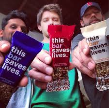
Ryan Devlin, Todd Grinnell and Ravi Patel have traveled to Africa on a humanitarian trip a few years back, encountering children suffering from severe malnutrition get healthy through Plumpy’Nut®.
Learn How to Identify and Avoid Grant Scams
